Wednesday, 30 January 2013

Levendale

Levendale is a small settlement in the Southern Midlands Council area 53 km north of Hobart servicing the local farming community. The settlement has a historic primary school, established 15 April 1901, which also serves as a community centre and focal point for the area. In 2008, facing the threat of closure with falling enrolments, the community rallied to increase the population of the area and save the school
The first people to inhabit the Levendale area were the Portmairremener, a band of the Oyster Bay Tribe who lived mainly around the mouth of the Prosser River. Each winter various bands of the Oyster Bay Tribe congregated around the coastal areas of Great Oyster Bay to harvest shellfish and marine vegetables until the end of July, when swans and ducks arrived in the lagoons and riverine areas to lay their eggs and raise their young. In August the bands moved up the Little Swanport and Prosser Rivers to the Eastern Marshes to hunt birds, kangaroos and wallabies As summer drew near the bands moved further west towards the Central Highlands, only to return to the coast as autumn approached. No doubt due it its prominence, the Aboriginals would have used Mt. Hobbs as a reference point in their annual migrations. In 1830, a large fire was kept burning on the summit of Brown Mountain as a point of direction for Governor Arthur's Black Line, that ill-fated attempt to drive the remaining Aborigines towards the Tasman Peninsula where they could be captured.

This failure led Arthur in 1831 to appoint George Augustus Robinson to locate and bring in the remaining aboriginals. During October, Robinson camped at Hobbs Lagoon and passed over the head of Bluff River.
Due to the nearly impenetrable nature of the bush, Europeans did not settle at Levendale until the second half of the nineteenth century. Indeed, so dense was this bush that the area was originally known as "The Scrub".The first known settler was Henry Buscombe who selected 655 acres (2.65 km2) of land at Levendale in 1842, calling his property Cutting Grass Marsh. In 1845, Henry's brother James purchased a 50-acre (200,000 m2) block alongside his brother's property at the Cutting Grass Marsh. Sometime between 1852 and 1868 a William Hodgson became the third person to take up land in the area when he purchased 709 acres (2.87 km2) a Levenbanks.The assessment roll for 1858 shows John McConnon leasing 100 acres (0.40 km2) near the Prosser River and in 1861 he was leasing 1,000 acres (4.0 km2) from the Crown at Prosser River. By 1868 John and his son John William McConnon were leasing 820 acres (3.3 km2) at Levenbanks and in 1870 John is recorded as owning 80 acres (32 ha) with a hut on the land. Following the deaths of the Buscombe brothers (Henry 1844: James 1851) a William Brown leased the Buscombe's blocks in 1861. In 1873 Kele Balsley, a native of Denmark who had apparently jumped ship at the Saltworks near Little Swanport in 1865, purchased 24 acres (9.7 ha) of land at Levendale where he built a family home.The 1880s witnessed a rapid increase in settlement. Settlers taking up land at this time were: Colin Patterson and Michael Powell (1883), the brothers Montgomery (1886), Harold Burrows (1887) and William Crawford who built a house at Levendale in 1897. By the end of the century over two hundred people lived at Levendale.

The first task facing these early settlers was of course to carve out farms and homes from the dense bush – a thankless and difficult job. At first this work was carried out by hand, the settlers ring barking trees and cutting the undergrowth with axes and slash hook, the ash from the annual summer burnings used as fertilizer to help in the growth of grass and clover for cattle. The introduction of horses and bullocks at least provided some relief from the hard task of settlement. The settlers' first homes were built from split timber with shingle roofs. As there was no running water, one of the main daily tasks was the carrying of water from nearby creeks, a responsibility often given to the youngest members of the family. As most homes had no bathroom, bathing was done by hip bather, the water heated in tins on open fires or wood stoves. Hurricane lamps and candles provided the only source of light. Of course the settlers of necessity had to be nearly self-sufficient in such a remote settlement.

Straight-grained trees that split easily were used to provide palings and posts for buildings and fences; vegetable gardens were established, and each household produced its own milk, butter and eggs. Meat came from the farm's own livestock, and if that source of supply fell short then there was always the ever-present wallaby or rabbit to tide the family over. The preservation of food was always a problem, but salting down vegetables and the use of wet sand packs for butter in summer ensured a reliable supply of household necessities. The purchase of essential items such as flour, tea, sugar and salt meant a fairly arduous journey to either Oatlands or Sorell every three months.

Whilst most of the young men worked on the farms, either their own or a neighbor's, many traveled around the district shearing sheep or working as farm hands for the wealthier farmers. Sawmilling also was an important part of the area's history. This industry also supplied local men and boys with employment. The earliest mills belonged to the Campbell, Barker and McConnon families. These were steam engine operated and supplied timber for many of the local homes and buildings.  Young women not employed at home usually found work as housemaids or a shop assistants until they married and had their own families; families that not uncommonly ran to thirteen or more children.

The continued growth of Levendale towards the end of the 1890s led to local demands for improved services to cater for the growing needs of the community. High on the list of priorities was a local school. Following strong representations from the Reverend T. W. Pitt, Church of England Minister at Spring Bay and the Hon. W. W. Perkins, M.L.C, the government agreed to build a school at Levendale.The decision to build the school seems also to have inspired the community to look for an appropriate name for the town, after all “The Scrub” State School must have had a peculiar ring to it, one that doubtless inspired little confidence.

Consequently, the opening of the school on 15 April 1901 provided the local community with the chance to hold a public meeting to decide upon a new name for the area. That meeting agreed upon the name Levendale, the first part of which was derived from the name of one of the oldest farms in the district, Levenbanks, belonging to Mr. V Hodgson, and later Thomas McConnon. And so the school opened with Mr. W. Duthie appointed first teacher in charge and with William Crawford and Frank McConnon registered as the first of what would eventually prove to be over 1000 students who would pass through the doors. As with most small country towns the new school offered not only a chance for and educations for the local children but a focal point for the whole community, many of the local events being organized around the school.

In 2013, Levendale Primary School is still the focal point for the whole community, boasting a student population at 23, community library, enthusiastic history group, zero to four learning program, playgroup, prekindergarten and many other activities. With the school under threat of closure in 2008 due to low student numbers, author and local resident Rachael Treasure proposed to the community that vacant farmhouses be put up for rent of $1 per week to attract more families to the area. The offer attracted interest from around Australia, New Zealand and as far afield as Japan and Singapore.


Monday, 28 January 2013

Colebrook

Located 54 km from Hobart and positioned between the historic towns of Richmond (to the south) and Oatlands and Ross (to the north), Colebrook is a quiet little farming settlement which was developed by convict labour as the site of a convict probation station.

The town was originally named Jerusalem. The area around Colebrook was first explored by Europeans in early 1804 and by 1806, with serious food shortages in Hobart Town, expeditions of soldiers were being sent into this area to kill kangaroos and emus. It is claimed that during one of these expeditions Private Hugh Germain, a well educated member of the Royal Marines, started giving various local sites exotic names.

Thus to the west of 'Jerusalem' (Colebrook) lies the incongruously named village of Bagdad and north of the town, past Lake Tiberius, is the village of Jericho. It is said that Germain travelled through the area with a copy of The Bible and the Arabian Nights and delighted in giving places religious and Middle Eastern names.

There is a story (more a legend that a hard fact) that the famous Tasmanian bushranger, Martin Cash, hid in a pear tree near the local police station after he had managed to escape from the village lockup.
People after 1834 called the town Colebrook Dale. It was officially named Colebrook in 1894

Colebrook has many historic buildings, including St. Patrick’s Roman Catholic Church, which overlooks the town and was built in 1856. The contract was signed for the erection of St. James Anglican Church on October 2, 1882. Hardwick Mill was working in 1871, but by the turn of the century had converted to a private residence and still is today.

The police building is also a private residence today and still contains two cells. Nichols Store, Pineholme and the former hospital have also survived up to now, proving Colebrook is rich in historical content.
‘The Chimneys’, now a private home, was the residence of the district constable in March 1854. In July 1854, it became a convent until it closed shortly before the 1967 bush fires.
The town was almost completely destroyed by the fires on February 7, 1967, but has since been rebuilt. Many buildings were lost. One side of the street was virtually wiped out with only one building here and there taken on the opposite side. Sadly, one life was lost, along with the state school, post office, the Railway Hotel, the two shops and many homes. The loss of stock was horrific.

The convent was reopened until a new state school was built. That school closed in August 1986, and was relocated at Dodges Ferry. Craigbourne Dam was officially opened on November 17, 1986. This brought about the loss of Colebrook Park, a two-story Georgian sandstone house built in 1822. Two private homes were removed before the area was flooded. One remained a private home; the other became a golf club house. The dam has brought irrigation to many farmers and excellent fishing for many anglers.

Colebrook has lost a few facilities over the years. The postal service has become an agency open for two hours each week day, the school children travel to Campania for their education and the police station is at Richmond. [Campania is the next town 10 miles south; Richmond is 5 miles south of Campania.]
The sports available in Colebrook are football, cricket, tennis, badminton, eight ball and darts.
A quiet walk down to Wallaby Rivulet or up to the waterhole filled from an underground spring rewards the patient observer with a glimpse of a platypus. Lots of birds live happily among the cattle, sheep, rabbits, wallabies and possums.

In 2010, the Tasmanian Heritage Council revised the heritage listing of the Jerusalem Probation Station at Colebrook to reflect the site’s significant heritage values and archaeological potential.

In Tasmania there were actually 75 probation stations but little evidence of most of them remains, yet at this site the former courthouse, former Assistant Superintendent’s quarters, chapel and convict quarters are still visible The Jerusalem Probation Station site demonstrates several important aspects of convict administration in Van Diemen’s Land between 1834 and 1849 which was an important phase in the history of convict transportation and the use of convict labour. It’s probably little known that the former Jerusalem Probation Station is unusual because so much of the original probation station still exists. Well worth taking the time to check it out.

Saturday, 26 January 2013

The Convict & Colonial Era Begins

On 13 May 1787 a fleet of 11 ships, which came to be known as the First Fleet, was sent by the British Admiralty from England to Australia. Under the command of Captain Arthur Phillip, the fleet sought to establish a penal colony at Botany Bay on the coast of New South Wales, which had been explored and claimed by Lieutenant James Cook in 1770. The settlement was seen as necessary because of the loss of the thirteen colonies in North America. The Fleet arrived between 18 and 20 January 1788, but it was immediately apparent that Botany Bay was unsuitable.
On 21 January, Phillip and a few officers travelled to Port Jackson, 12 kilometres to the north, to see if it would be a better location for a settlement. They stayed there until 23 January; Phillip named the site of their landing Sydney Cove, after the Home Secretary, Thomas Townshend, 1st Viscount Sydney. They also had some contact with the local aborigines.

They returned to Botany Bay on the evening of 23 January, when Phillip gave orders to move the fleet to Sydney Cove the next morning, 24 January. That day, there was a huge gale blowing, making it impossible to leave Botany Bay, so they decided to wait till the next day, 25 January. However, during 24 January, they spotted the ships Astrolabe and Boussole, flying the French flag, at the entrance to Botany Bay; they were having as much trouble getting into the bay as the First Fleet was having getting out.
On 25 January the gale was still blowing; the fleet tried to leave Botany Bay, but only the HMS Supply made it out, carrying Arthur Phillip, Philip Gidley King, some marines and about 40 convicts; they anchored in Sydney Cove in the afternoon.
On 26 January, early in the morning, Phillip along with a few dozen marines, officers and oarsmen, rowed ashore and took possession of the land in the name of King George III. The remainder of the ship's company and the convicts watched from on board the Supply.
Meanwhile, back at Botany Bay, Captain John Hunter of the HMS Sirius made contact with the French ships, and he and the commander, Captain de Clonard, exchanged greetings. Clonard advised Hunter that the fleet commander was Jean-François de Galaup, comte de La Pérouse. The Sirius successfully cleared Botany Bay, but the other ships were in great difficulty. The Charlotte was blown dangerously close to rocks; the Friendship and the Prince of Wales became entangled, both ship losing booms or sails; the Charlotte and the Friendship actually collided; and the Lady Penrhyn nearly ran aground. Despite these difficulties, all the remaining ships finally managed to clear Botany Bay and sail to Sydney Cove on 26 January. The last ship anchored there at about 3 pm.
Thus began the convict, and ultimately, the colonial era in Australia.

Australia Day (previously known as Anniversary Day, Foundation Day, and ANA Day) is the official national day of Australia. Celebrated annually on 26 January, the date commemorates the arrival of the First Fleet at Sydney Cove, New South Wales in 1788 and the proclamation at that time of British sovereignty over the eastern seaboard of Australia (then known as New Holland).

Note that the formal establishment of the Colony of New South Wales did not occur on 26 January, as is commonly assumed. That did not occur until 7 February 1788, when the formal proclamation of the colony and of Arthur Phillip's governorship were read out.
Happy Australia Day!!


Friday, 25 January 2013

Alexandra Battery


The Hobart Coastal Defences are a network of now defunct coastal batteries, some of which are inter-linked with tunnels, that were designed and built by British colonial authorities in the nineteenth century to protect the city of Hobart  from attack by enemy warships. During the nineteenth century, the port of Hobart Town was a vital re-supply stop for international shipping and trade, and therefore a major freight hub for the British Empire. As such, it was considered vital that the colony be protected. In all, between 1804 and 1942 there were 12 permanent defensive positions constructed in the Hobart region.


As the colony began to grow larger, more British Units were sent to serve in the settlement of Hobart Town. Amongst one of these contingents was a commander of the Royal Engineers named Major Roger Kellsall. When he arrived, he assessed these two fortifications, and wrote in his report that he felt the colony was virtually undefended.
He devised an ambitious plan to fortify the whole inner harbour of the Derwent River with a network of heavily armed and fortified batteries located at Macquarie Point, Battery Point and Bellerive Bluff on the eastern shore. He envisaged the forts all having an interlocking firing arc, which would cover the entire approach to Sullivans Cove, making it impossible for ships to enter the docks or attack the town unchallenged.

The scale of the plan was enormous for such a small colony, the population being approximately 20,000 in the 1830s. The small population meant the cost was too prohibitive, considering that at that period the British Empire enjoyed relative peace with the exception of border conflicts in India.
By 1855, the colony of Van Diemens Land was granted responsible self-government by the colonial Office, and renamed Tasmania. The Colonial Office began to pressure the newly formed local government to take more responsibility for the self-defence of the colony.

As a result of these calls, the Tasmanian colonial government began to establish Volunteer Local Militia Forces. One such force, established in 1859 was the Hobart Town Artillery Company under the command of Captain A. F. Smith, formerly of the 99th. (Wiltshire) Regiment, who began to assume responsibility for the Hobart fortifications from the Royal Artillery who were increasingly being withdrawn, and had all departed well before the withdrawal of the last British forces from Tasmania in 1870. Prior to this, in 1868 a Defence Proposals paper had been published which outlined the need for greater defensive fortifications. It also suggested the need for proposed batteries further to the south of Hobart Town on either side of the river.

Improvements to ship’s armaments meant that the existing fortifications, which provided covering fire to a range of approximately 2,000 yards (2,000 m), would allow enemy ships to ship outside the range of the defenders guns and still be able to bombard the town. This left the colony virtually defenceless.
The arrival of three Imperial Russian Navy warships, the Africa, Plastun, and Vestnik in 1872 caused a great deal of alarm in the colony. Britain and its empire had only been fighting the Crimean war with the Russians 16 years previously. The colony was virtually defenceless, and had the Russians had hostile intent, would probably have easily fallen. Luckily the Russians were on a good will mission, however, it cause a great deal of debate about the state of the colonies defences.

It had also highlighted the state of decay the existing fortresses had reached. Another Commission was carried out, and it was decided the Mulgrave, Prince of Wales and Prince Albert Batteries were inadequate for the defence of the town. By 1878, both had been condemned, and were dismantled by 1880. In 1882, the sites were handed over to Hobart City Council for use as public space, although the tunnels and subterranean magazines remain. Most of the stonework was removed and reused in the construction of the Alexandra Battery further to the south.

Following the condemnation of the Mulgrave, Prince of Wales, and Prince Albert batteries in 1878, it was decided to re-institute the plans for the alteration of the defensive strategy around the entrance to Sullivans Cove that were first drawn up in 1868.
A triangle of fortresses with the Queens Battery at the Apex, and two new Batteries, the Alexandra Battery, named for Princess Alexandra, the Princess of Wales, and the Kangaroo Battery on the eastern shore would be adequate for the task. Construction began on the new fortifications in 1880, and at the same time, a new permanent field artillery unit, the Southern Tasmanian Volunteer Artillery equipped with two breech-loading 12 pound howitzers and two 32 pounder guns on field carriages, was raised.
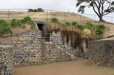
Following the dismantling of the Battery Point batteries, much of the stonework was relocated to the site of the Alexandra Battery. The site of the Alexandra Battery is now a public park with commanding views of the river, and much of the original construction is still accessible.
Alexandra Battery & Kangaroo Bluff Fort, on the opposite side of the Derwent River, are excellently preserved examples of colonial era defences and walking through and exploring each site gives you a real feel for what it must have been like to be posted to serve at one of the two fort sites. A must see, along with the Kangaroo Bluff fort site for any colonial history enthusiast.

Wednesday, 16 January 2013

Oatlands

The historic and beautiful township of Oatlands is located 79 km north of Hobart and 115 km south of Launceston on the Midlands Highway (Heritage Highway).
The area was first formally explored by Europeans when Governor Lachlan Macquarie and his party passed through in 1811. It was another decade before Macquarie returned to the district. On the second visit he recognised the present site as 'a very eligible station for a town' and, according to a local plaque, he named the town 'Oatlands' on 3 June 1821. The name reputedly referred to a rich grain-growing area of Macquarie's native Scotland.

Oatlands' importance was guaranteed in 1821 when Macquarie decided to establish a road from George Town (at the time it was known as Port Dalrymple) to Hobart. A number of military posts were established along the road and Oatlands was chosen as one such site. It was developed as a military base for the control and management of convicts because of its central location between Hobart and Launceston. Convicts were assigned to nearby farms and properties, and also worked on public buildings, roads and bridges.
In the following five years a few settlers moved into the area but it wasn't until the arrival of a military detachment in 1825 that it began to develop.

The early history of the town is a reminder that the local Aborigines did not give up their land without a fight. Lieutenant-Governor George Arthur's decision to lay out a town meant that some 35 workers were sent to the town to construct buildings, clear the ground and create new roads. This small group was at such risk from Aboriginal attack that the troops were sent to guard them. It should also be remembered that Arthur had a rather fanciful notion of rounding up all the Aborigines on Van Diemen's Land and that Oatlands was the centre of these operations. They were famously unsuccessful, spending vast numbers of hours and resources. The Aborigines simply slipped through the infamous 'Black Line' each night and the troops returned after weeks of hunting down the indigenes with only a small boy and an old woman to show for their labours.

In 1832 the town was surveyed by Surveyor Sharland who, believing that Oatlands would eventually become one of Tasmania's major centres, marked out more than 80 km of streets.
There are a number of unique landmarks in Oatlands, including the Callington Mill (See Callington Mill post) http://ontheconvicttrail.blogspot.com.au/2013/01/callington-mill-oatlands.html and St Pauls' Church. The mill was built in 1837 and was restored to working order during June/July 2010, and the Catholic Church was designed by Augustus Welby Pugin, the father of Gothic Revival architecture.
For some years after 1848, Oatlands was the place of exile of the Irish nationalist leader Kevin Izod O'Doherty, where his stone cottage still stands.
A railway connected Oatlands with Parattah Junction, on the main Hobart to Launceston line. The railway opened on 13 May 1885 and it closed on 10 June 1949.
In the next decade the town grew rapidly so that it now has arguably the finest concentration of Georgian buildings of any town in Australia.

The Oatlands Court House is an historic Georgian building in Oatlands. Built by convict labour in 1829, the Oatlands Court House is the oldest supreme court house in rural Australia and the oldest building in Oatlands. This fine example of a Georgian public building was originally constructed as a combined Chapel and Police Office. It was purchased by the National Trust in 1977.

In the 19th century Tasmania’s historic Midlands was home to pioneering farmers, convict workgangs and bushrangers. It was also the home of the colony’s most notorious hangman, Solomon Blay.
In addition to working the gallows at the local Oatlands jail Blay also performed his trade at the Hobart Penitentiary, over 80 kilometres (50 miles) away.
According to local legend Blay’s wages were so low that he could not afford a horse and he was so reviled that no stagecoach would pick him up. Not only was his job as hangman one of the worst occupations in colonial Van Diemen’s Land, but Blay was so despised he would have to walk, swag on back, for three days to reach Hobart Town and the gallows at the Old Hobart Penitentiary (the very same gallows are still on display at the Campbell Street site). (See Penitentiary Chapel post) http://ontheconvicttrail.blogspot.com.au/2012/12/penitentiary-chapel.html

Oatlands was generally a relatively prosperous town in the 20th century but by the 1990s the Tasmanian economy slump, the highway bypass and a Tasmanian Midlands rural drought had a very negative effect on the town. Much of Tasmania's economic renewal, like the highway, has bypassed Oatlands, along with Ross, Tunbridge, Kempton, and soon to be Pontville, which today is a lot quieter than it used to be. The residents are attempting to grow the town once more by making it a peaceful local centre with a tourist friendly image. Oatlands is also home to the world renowned Casaveen Knitwear.

Modern Oatlands is a service centre for the surrounding farming community. It has the usual array of modern facilities which blend successfully with the town's historic past. Oatlands has the largest collection of sandstone buildings in a village setting in Australia. The town’s authentic colonial character is reflected in the original sandstone buildings along the town’s main street. With over 150 sandstone buildings, it has the largest collection in any Australian town, many built by convict labour. Its intact Georgian townscape offers a complete representation of the architecture, urban design and the cultural heritage of early European settlement in Australia. Many of its old cottages are now cafes, antique stores or restaurants. The Midland Highway bypasses the town these days, but it's worth taking the short detour to spend some time in Oatlands.